Muggaccinos.com The Bullsheet
Australia Day long w'end Audax Alpine Classic on Sunday, 26 Jan '14
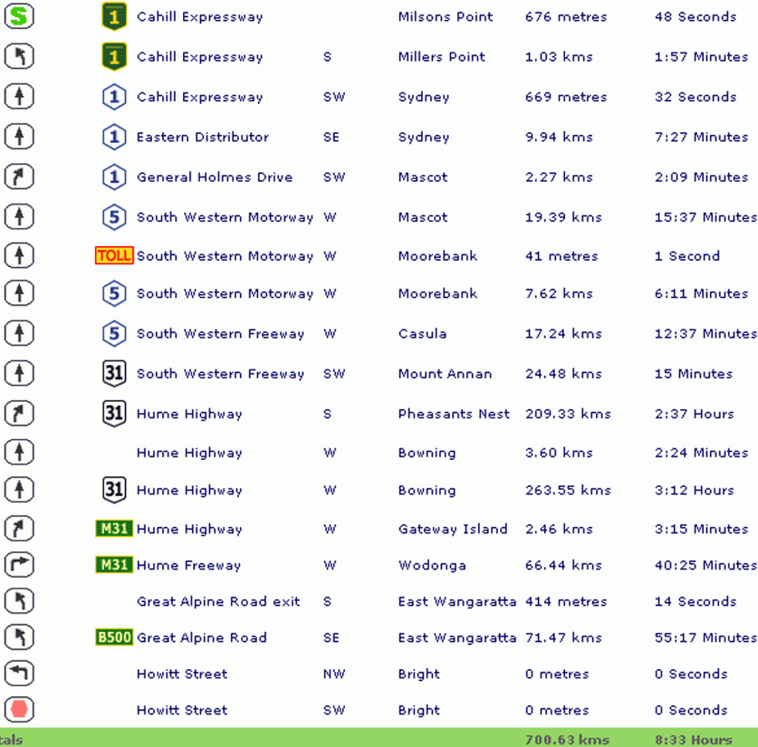
Hardcopy this Bullsheet and these street directions from Sydney Harbour Bridge to Bright - 700.63km - 8½ hrs driving time
Muggaccinos’ Sunday rides during Dec/Jan roll out at sparrow fart/cock’s crow to beat the heat and ensure adequate daylight to complete requisite long training rides in preparation for the prima endurance event on the annual cycling calendar in the Mecca of road cycling country, The Vic. Alps.
The Alpine Classic evidences endurance cyclists from across Aust flock to the pristine town of Bright in the foothills of the Vic Alps twds the end of Jan for the annual pilgrimage where the splendid mountainous terrain proffers entrants in 6 ride distances (from 60km to 250km) from Howitt Park, Bright.
The pre-eminent 200km event contains 4 tough
ascents:
* NEE up Towonga Gap 11km,
* NNE up Falls
Creek 29km,
* SWW up Towonga Gap 8km (from
the steeper side); and
* W up Mt. Buffalo 22km.
These four marvellous climbs aggregate 3,700m of pedal pumping, quad draining, elevation.
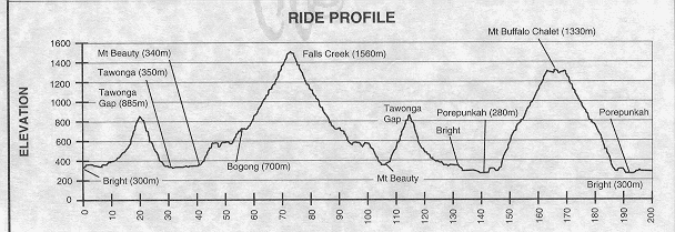
The 200km Audax Alpine Classic
profile
|
Below are current Muggs, or former Muggs, who have registered for a 2014 ride:
|
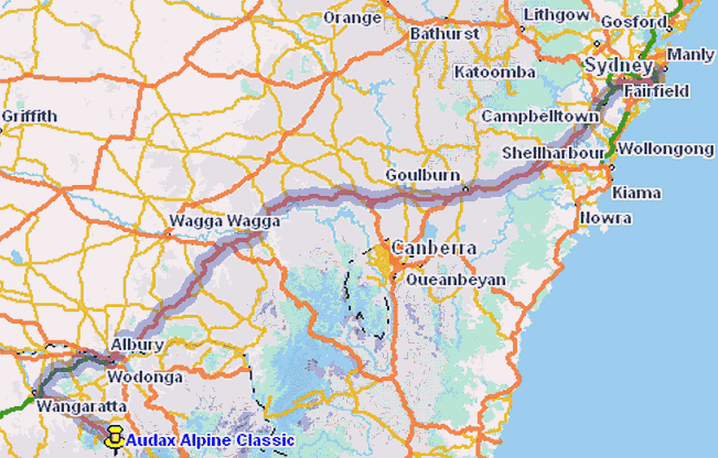
You might think you are driving South, but, in fact, you head lots more West, albeit hooking back SE after Wangaratta
What does the above map show you? Not a lot. It is as
boring as batshit driving 680km to the Vic. border and onto Wodonga.
However, voila the landscape and scenic beauty increase exponentially the
more you drive Sth. into Vic.
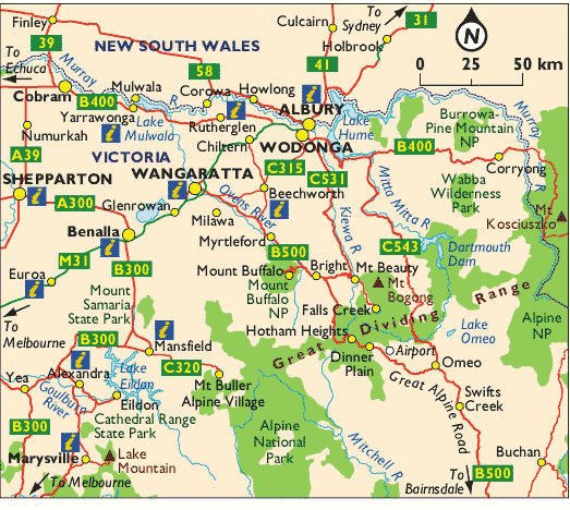
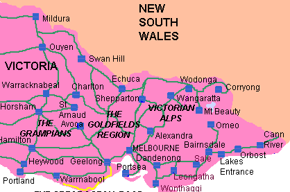
Au
milieu de this map is the quaint,
pristine township of Bright in the foothills of the Vic. Alps. Falls Creek
is SE. "The Giant" Mt Hotham is Sth. Mt Buffalo is due West.
Scribe last updated on 8 Jan '14