|
| |
Muggaccinos.com
The Bullsheet
Sunrise in 6:46am
We may skip Duffy's Forest, 'cause we rode it last Sunday
Sunday, 22nd May '16 by 8am from
St. Ives
carpark for "Brunch at Warriewood" -
return
via Wakehurst Parkway - 94km
- ETR 1:25pm
|
WHO, WHEN, WHERE:
Ride
Organiser: Phil Johnston aka
BankTeller
0434
715.861 [1st Responder],
Jane aka NeoLuddite
[2nd Responder],
Barry aka Bazza
[2nd Responder]
.......
are starting by 8am
from
St. Ives carpark.
Chris aka
Recalcitrant
BankTeller
[4th Responder],
Alan aka
PharLap
[6th Responder]
expects to meet us at
Terrey Hills
Vale Fruit Barn
around 7:35am, or somewhere along 'longish' Booralie Rd heading to Duffy's
Forest.
Trevor aka
Tornado [5th Responder] plans to
meet us at Church Point around 10:10am.
Grant aka BeanCounter
Lea aka SlowLea,
Matt aka
GreenMonkey,
John aka
L'Etape,
Kev aka TexDubbo,
Terry aka
Navigator,
Jean aka
ChiliDog,
Ron aka Draughtsman,
Tony aka Publican,
Lea aka
SlowLea
Bill
aka Glasgow,
Tony aka Yorky
APOLOGIES:
Pete aka CampyAficinado
is Butcher's Hook
having caught the dreaded lurgie
Eric
aka PapaBear is
driving to the Sunshine Coast to cycle with fellow Muggs
If you want to join us, please e-mail
Bank Teller
and he will add your moniker above. |
|
Rollout from St Ives car
park
for Terrey Hills, Duffy’s Forest, West Head (1st Nosh Stop – pack nibbles),
Church Point, Warriewood (2nd Nosh Stop).
Return Wakehurst Parkway, Forest Way and Mona Vale Rd.
NoshStops:
1st:
Sunrise Cafe overlooking
Warriewood Beach (35
min)
SagStops:
1st:
Terrey Hills Thai Restaurant (5 min)
2nd:
West Head
Lookout (15 min)
|
|
1st
Leg: St Ives via traditional route along
Booralie Rd to
Duffys Forest, thence to West Head - 41km - 115 min
Depart
St Ives
carpark by 8am
depending on your ride speed:
-
E along Mona Vale Rd
for
6.2km;
-
L into
Myoora Rd passing Forest Way - at
Terrey Hills
Vale Fruit Barn;
-
3km along Myoora Larool Rd until
Tepko Rd which is
70m before Booralie Rd;
-
L into
Tepko Rd (70m short
of Booralie Rd) for
400m;
-
L into Booralie Rd
and pedal like "shit out of
Shanghai" 6.7km flat/fast stretch past Terrey Hills Golf Course
and rifle range to Duffys Forest (amidst real pigs, goats, horses 'n cows);
-
"U"
turn at the dead-end of Cow Corner –
slower cyclists must turn around as soon as they see lead cyclists returning to via same route Terrey Hills neighbourhood shops
and pull-up opposite
Terrey Hills Thai Restaurant - 1st Sag Stop
(5 min);
-
Left down McCarrs Creek Rd
and entering Ku-ring-gai Chase National Park for 3km to "V" (dual entrances to the park);
-
R
at the "V" anti-clockwise and descend
to
McCarrs Creek;
-
L
over small timber bridge for 1.8km to "T" juncture
(Akuna Bay Marina is
2.8km on LHS);
-
Ahead 12km along West Head Rd to our 2nd
Sag Stop at
West Head.
Read below Risk Warning about a dangerous
'Blackspot' 100metres before the Lookout.
Pack lots of nibbles,
‘cause we take our 2nd Sag Stop (15
min) from
9:55am for a snack and
a gawk at the majestic, shimmering blue
peninsula where The Greenies blocked the proposed McChucks on
the Headland.
2nd
Leg: West
Head to Warriewood - 28km - 75 min
10:10am
-
-
Return
12km to "T" juncture with Akuna Bay,
-
Ahead
descending 1.8km to McCarrs Creek small timber bridge [55km],
-
L
into
McCarrs Creek Rd for 8.8km past Church Point around 10:10am, then Bayview Marina to
Cabbage Tree Rd,
-
R into Cabbage Tree Rd from 11:35am with Bayview Golf Course on LHS);
-
Ahead for 1.5km leads into Samuel St and crosses
Mona Vale Rd at roundabout,
-
Ahead into Ponderosa Pde veering Left
becoming McPherson St for 2km to
Warriewood Rd
-
R
into Warriewood Rd 200m crossing Pittwater Rd at traffic
lights and immediately climbing up Hunter St [dog-leg
L, then
R]
which leads to views of Blue Pacific overlooking majestic
Warriewood Beach [around 11:25am -
69km]
for 1st Nosh Stop (35 min)
at the
Sunrise Cafe.
A neighbourhood, strip-front shopping centre is
immediately on RHS in Narrabeen Park Pde.
Nautilus Café is about 4 shops along.
Sunrise
Cafe, on the
corner makes grouse burgers.
3rd
Leg: Warriewood
beach cafés to St Ives, via Wakehurst Parkway - 26km - 85 min
12:00pm -
-
Sth
adjacent to the coast for 2km - initially along Sydney Rd which
becomes Ocean St;
-
R into Malcolm St for 50m;
-
L
into Lagoon
St for 1km;
-
R into Waterloo St
for 300m;
-
R into
Pittwater Rd for 100m crossing bridge over Narrabeen Lakes;
-
veer L into Wakehurst Parkway for a toughish 9.9km
(initially flat past
Narrabeen Lakes thence a constant climb) for
Sag Stop
(5 min)
approaching
crest of climb under shade of trees 100m prior to traffic lights at French Forest
Rd or at the lights, so long as you get off the road;
-
R
into French Forest
Rd at lights for
800m;
-
R into Rabbett St
for 200m decent;
-
L into Adams St for a 200m "real tough" grind/climb;
-
R onto Forest Way for 5.3km; and
-
L into Mona Vale for
6.2km to St Ives.
ETR 1:25pm -
94km.
|
|
Risk
Warning
Blackspot Warning.
The road section approx 250m prior to the West Head Lookout veers
awkwardly to the right. It is narrow with very little camber to
enable cyclists to hold the narrowing corner.
Bank Teller has documentary evidence of 5 bad accidents when
inexperienced cyclists descended that road section too fast and spun off
to the LHS. One cyclist remained in a comma for three months.
Descend to the West Head Lookout slowly and warn others to do likewise.
RTA, which is responsible for West Head Rd, has been negligent in
ignoring
Scribe's
Three Letters dated 11 Jan 08,
8 Feb 08 and 29 March ’08 and
Annexure to -
a) straighten approx 200m of that road
section by widening on the RHS,
b) build up the camber on the LHS, and
c) provide dedicated "Cyclists SLOW DOWN"
signage.
Some
forms of cycling are dangerous.
An ave of 38 Australian
cyclists have been killed annually since 2000.
95% of these fatalities occur on the road.
Other cyclists in Australia break bones and incur nerve
impairment from falling off their bikes in accidents.
A cyclist could fall from his/her bike, inter alia,
due to -
(i) being hit by a car or another cyclist; or
(ii) encountering a pothole;
(iii) cycling too fast on a wet downhill where the
coefficient of friction is much less, particularly at corners; or
(iv) getting their bicycle wheel caught in a gap in a timber bridge.
A negligent cyclist could -
(a) be litigated by a seriously injured cyclist, or
third party (ie. a
woman pushing a pram on a footpath or a car driver) under common law
where the damages could exceed $500,000; and
(b) lose his/her home if he/she did not have public liability
insurance which covers their negligence whilst on a push bike.
A negligent cyclist who did not have personal injury
insurance (ie self-employed without income protection cover) could
struggle to meet regular outgo commitments.
A seriously injured cyclist could be awarded damages
which a negligent cyclist could not afford to pay if the negligent
cyclist -
(I) did not have public liability insurance cover; and/or
(II) did not possess valuable assets.
Ø Cycling
without Public Liability cover is as silly as driving without 3rd Party -
join Bicycle NSW for PL insurance, so that all Muggs are better protected
Ø
Click on:
Risk Management
which warns of 'inter alia', the dangers of cycling on
public roads with motor cars,
potholes and over bridges with vertical timber planks with gaps
Ø
Cycling with
Muggs is predicated upon notifying
Bank Teller if you
materially disagree with any clause(s) in Muggaccinos'
"Ride Participants Liability Acknowledgment"
|
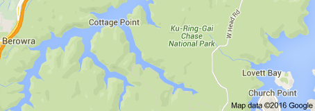
Pics from last Sunday's St Ives,
Duffys' Forest, Akuna Bay, Cottage Point, Church Point - 65km - 7 riders
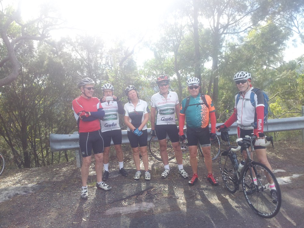
We rode a lumpy 2km into Cottage Point to an apex. The broad
expanse of blue water behind us is Coal & Candle Creek. Mighty big for a
creek. Hate to see what a river or an
estuary
or a tributary looks like.
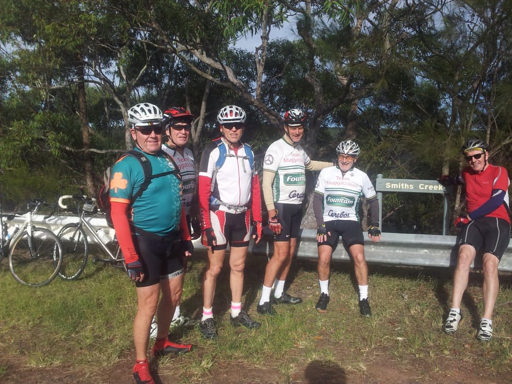
Don't know where Smith's Creek is? Or how big it is?
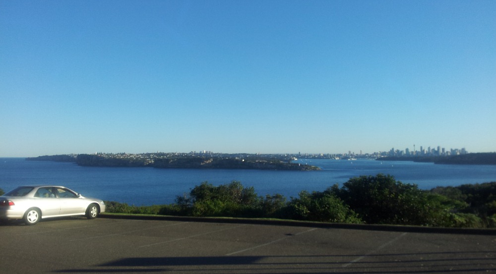
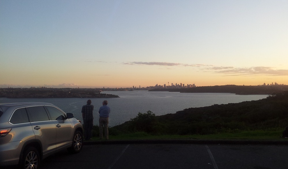
Bank Teller rides to North Head once
or twice midweek. Two good hills. Below pic is at dusk. Them
their buildings on RHS is Sydney CBD
Scribe
19 May '16 | |
|