Formerly our Nanna's land at Milton Rd, Marsden Lane and Chaucer Rd, Riverstone
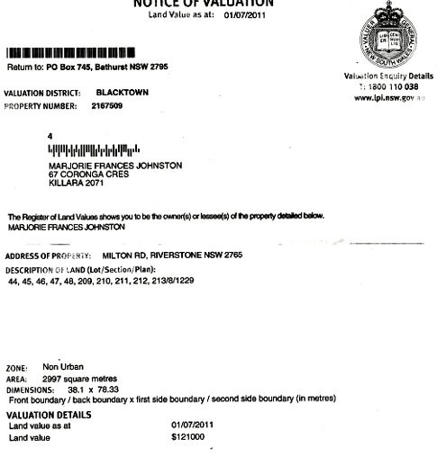
Riverstone Lot numbers noted above
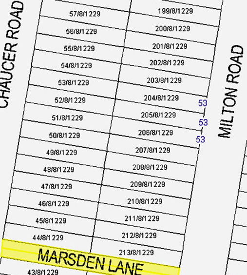
Nanna's land is the lowest five Lots facing Chaucer Rd and lowest five Lots facing Milton Rd, as numbered in further above Council Rates notice.
Above data accessible at BCC MapsOnline (nsw.gov.au)
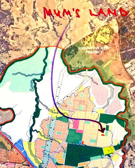
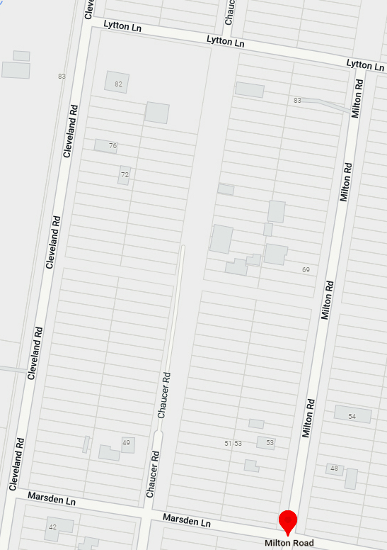
Nanna's land bounded by Milton Rd, Marsden Lane and Chaucer Rd
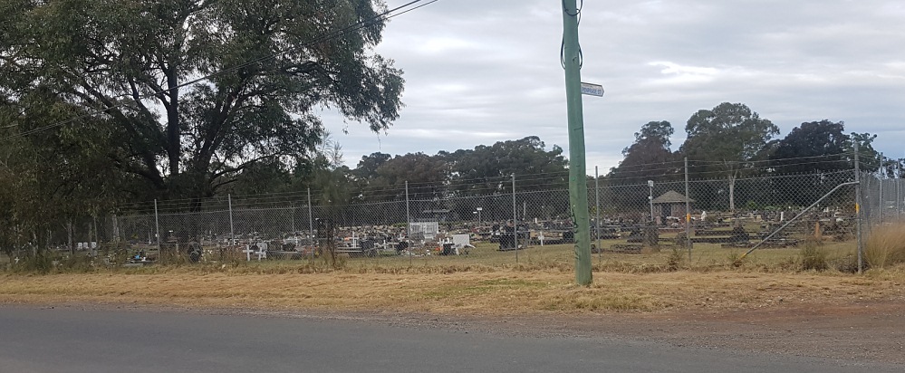
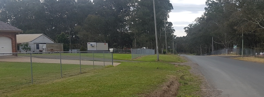
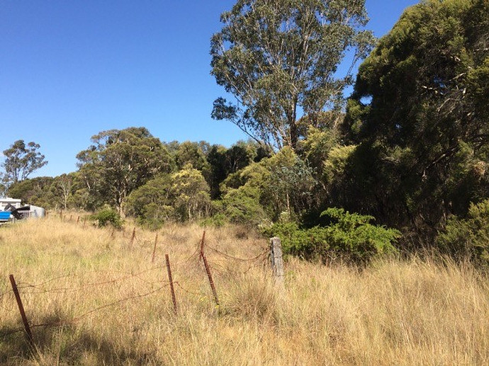
The nearby cemetery is slightly below Nanna's land level
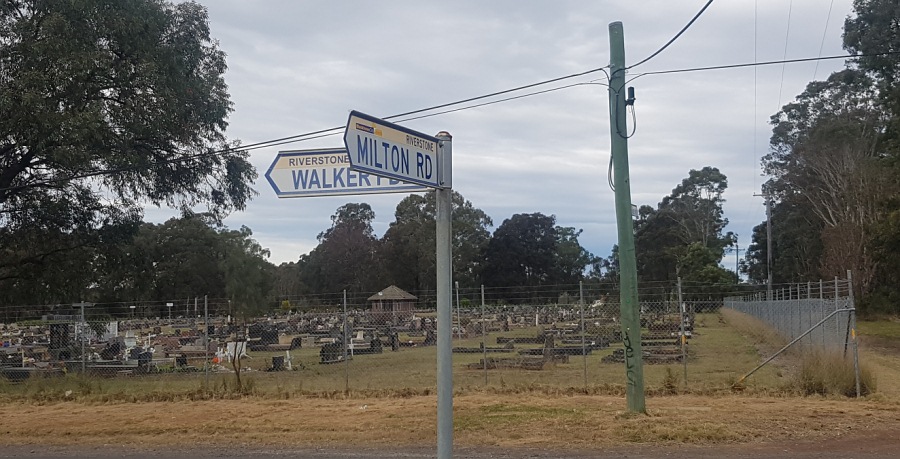
Cnr of Milton Rd and Walker Pde
Above pic is the LHS of below pic
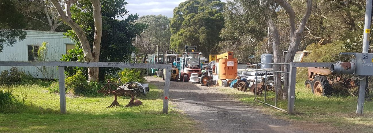
I chatted with an Old Codger named Jim who came from the above worksite in Milton Rd. Jim asserted that Nanna's land and the nearby lands, incl the cemetery, have never flooded and would be unlikely to ever flood because they are not in the lowlands
There is a tiny white Right Turn sign on RHS of above pic to signify the Cnr of Milton Rd and Marsden Lane
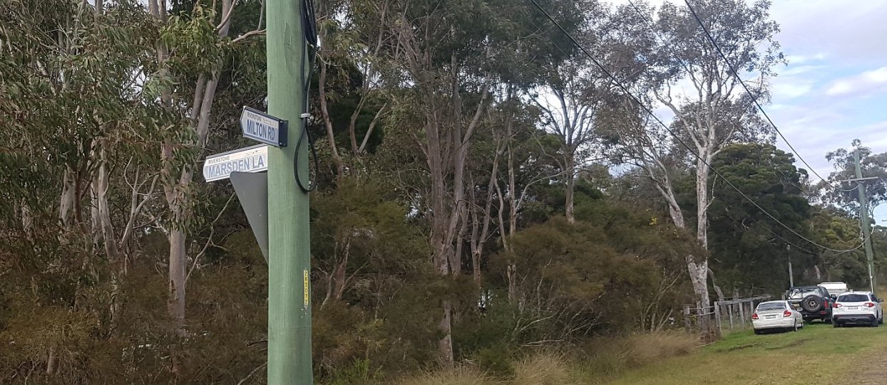
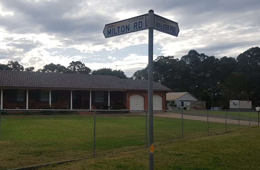
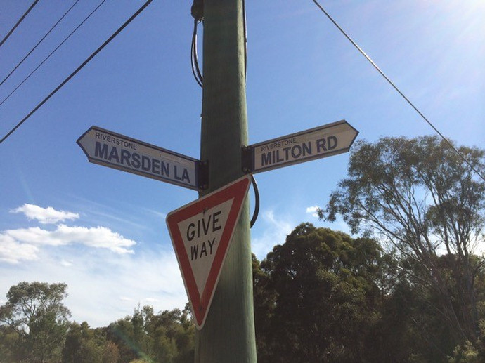
Above is one of the boundary corners of Nanna's Riverstone land - Cnr. Marsden Lane and Milton Rd
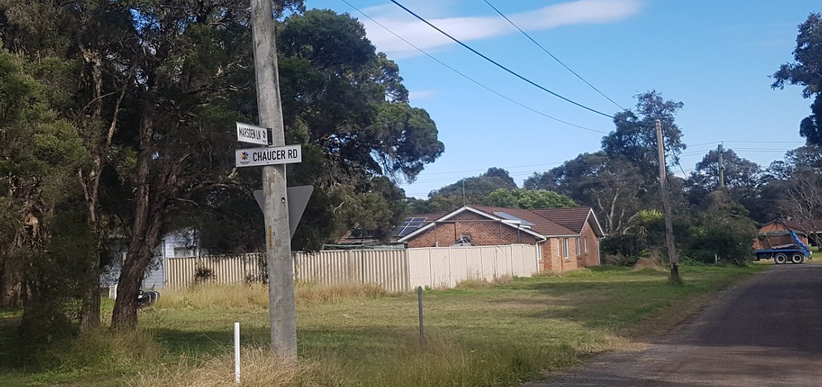
Above is another boundary corner of Nanna's land - Cnr. Marsden Lane and Chaucer Rd
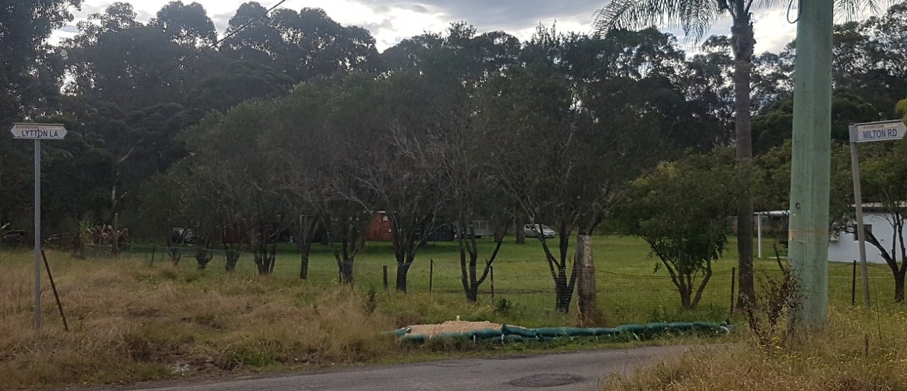
Above pic is the other end of Milton Rd - away from Nanna's land
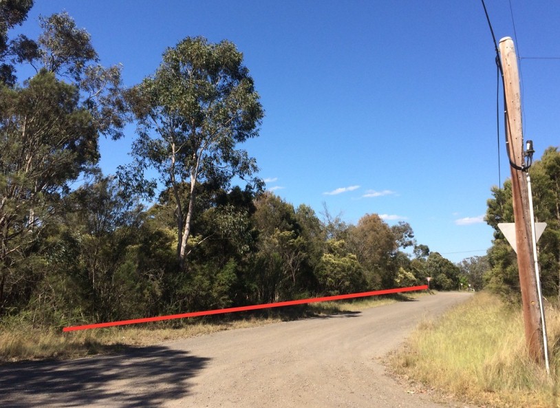
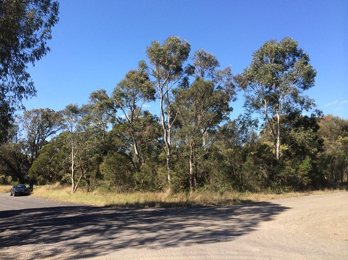
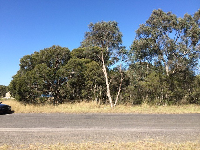
Below are seven pics that Anthony took in 2016 of Nanna's land at Angus (formerly Riverstone).
"It is bounded by dirt roads on 3 sides and by adjoining land on the other. Our land is next to a residence at one end, down Milton Road.
The 3 roads are Chaucer Road, Marsden Lane and Milton Road.
I have marked up one below photo with a red line, which shows the frontage of our land to Marsden Lane (its longest boundary). In the distance it stops at a “give way” sign (just visible) where Marsden Lane intersects Milton Road. It’s quite a large piece of land.
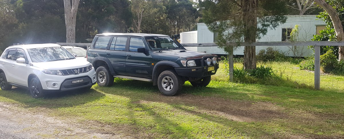
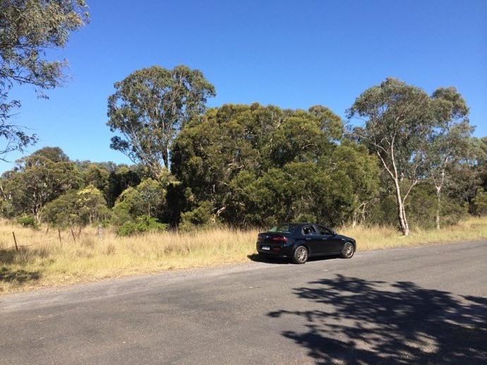
The photo which includes my black car (taken from Chaucer Road) is aimed at one corner of our land. The vegetation in view in that photo is all on our land."
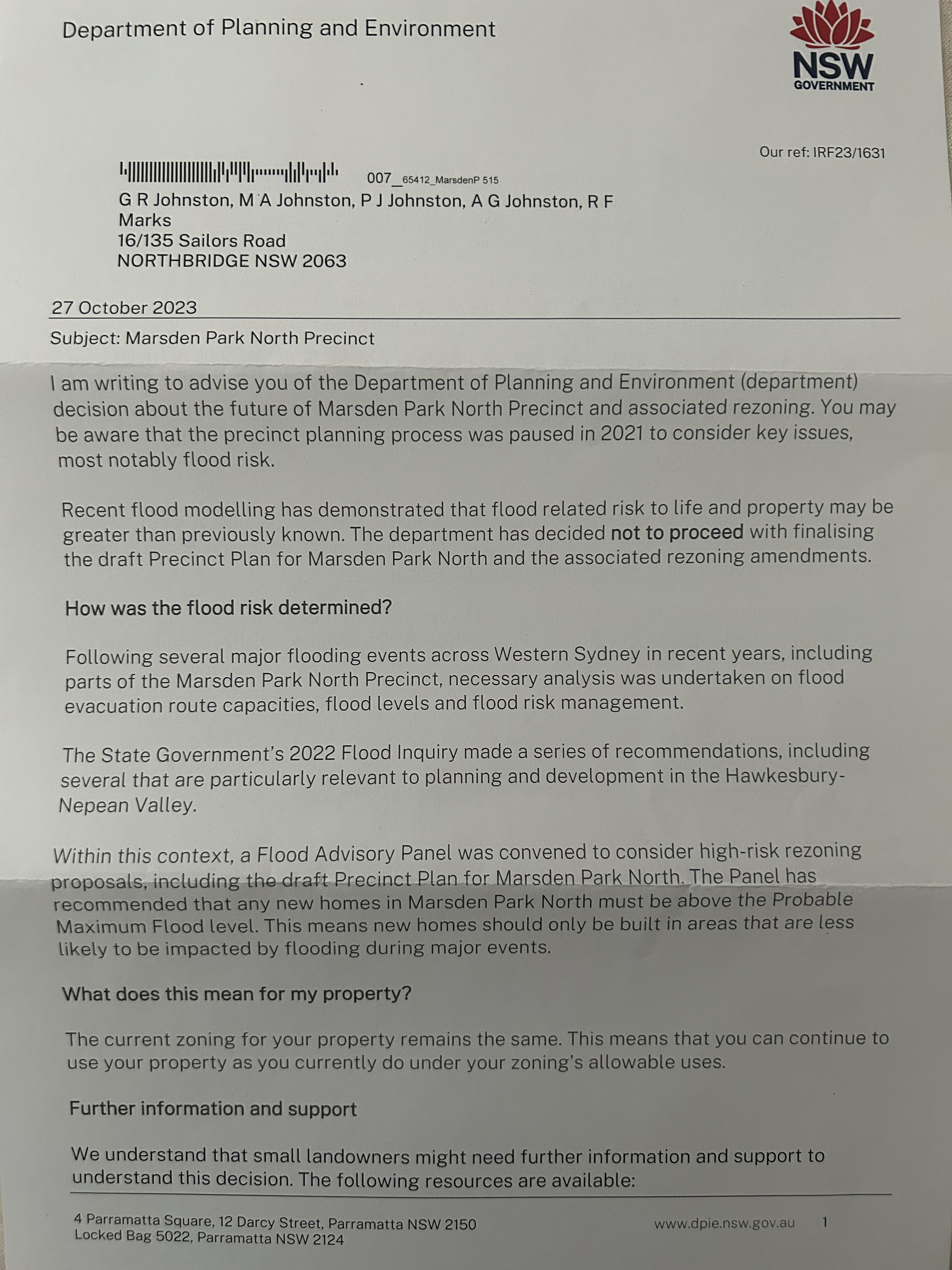
NSW Dept of Planning & Environment letter to Johnston siblings dated 27 Oct 2023 - pg 1 pg 2
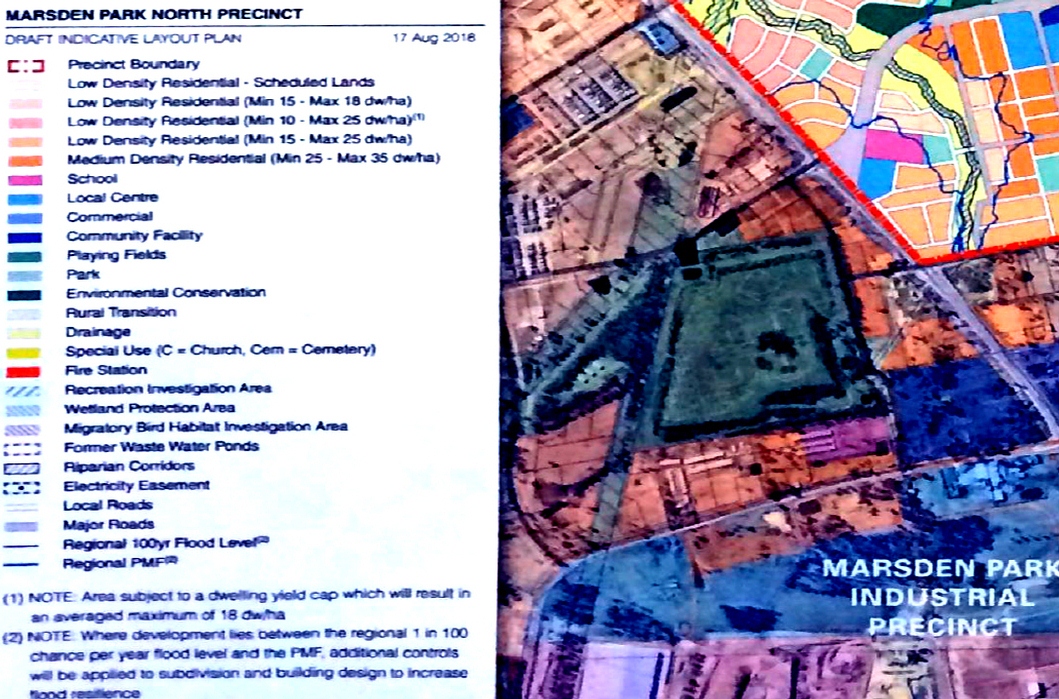
Below is an extract from Marsden Park North – State-led rezoning - Finalisation Report - August 2023
"The Marsden Park North Precinct is subject to flooding from the Hawkesbury River, South Creek, Eastern Creek and localised flooding.
The dominant flooding source is from the Hawkesbury River. Figure 1 (Page 2) shows the Precinct’s draft Land Zoning Plan with the Hawkesbury River 1 in 100 chance per year flood and Probable Maximum Flood (PMF) extents.
The draft Precinct plan proposed no new dwellings below the 1 in 100 chance per year flood level and an upper limit of 4100 dwellings for land generally between the 1 in 100 chance per year flood level and the PMF. The 4100 dwelling upper limit was based on the Department’s understanding of regional flood evacuation capacities at the time of preparation of the draft Precinct plan.
In March 2021, late February/early March 2022 and July 2022 major flooding occurred throughout the Hawkesbury - Nepean River floodplain. These floods inundated widespread areas of Western Sydney, including parts of the Precinct.
The 2022 floods reached heights (at Windsor) of 13.8m Australian Height Datum (AHD) and 13.9m AHD respectively and were marginally higher than a 1 in 20 chance per year flood level (13.7m AHD).
The March 2021 flood reached a height (at Windsor) of 12.9m AHD and was approximately half- way between the height of a 1 in 10 chance per year flood level (11.9m AHD) and a 1 in 20 chance per year flood level."
Below are an extract from Hawkesbury-Nepean Valley Flood Risk Management Strategy.
"A large and complex floodplain
The Regional Flood Study covers Hawkesbury-Nepean River flooding from Bents Basin near Wallacia down to Brooklyn Bridge. It covers
a large area and includes the backwater effects of flooding in South Creek and Eastern Creek.
Modelling river flooding in the Hawkesbury- Nepean Valley is complicated because of the many tributaries and their catchments that contribute to the floods.
The main tributaries are:
» Nepean River
» Warragamba River
» Grose River
» South Creek
» Colo River
» Macdonald River.
Floodwaters from these tributaries back up behind natural choke points created by narrow sandstone gorges (see Figure 2). This can cause rapid, deep and widespread flooding."
"Effects of Warragamba Dam on river flooding
Warragamba Dam is located in a narrow gorge on the lower section of the Warragamba River, 3.3 kilometres before it joins the Nepean River near Wallacia.
The catchment above Warragamba Dam makes up around 80% of the total catchment to Penrith and 70% to Windsor. Therefore it has a major influence on flooding in the valley, contributing the majority of flows in the largest floods.
If the storage level behind Warragamba Dam is very low, it can help hold back the inflows during floods. However, in large rainfall events, the dam can fill and spill quickly. This is what happened in 1998, when the dam went from 56% storage level to full and spilling in around two weeks.
If the storage is close to full, the dam cannot hold these inflows back. History shows that most of the large floods occur during wet periods when the dam is nearly full. This variability has been taken into account in the new Regional Flood Study."
Below is an extract from - COLO RIVER LEVELS - March 11 2024
"The Colo River is a tributary of the Hawkesbury River in New South Wales, Australia. It is approximately 86 km in length and has a catchment area of 1,632 km2. The Colo River is used for agricultural purposes, including grazing and horticulture. It also serves as a recreational area for activities such as swimming and canoeing. The river is home to several dams and reservoirs, including the Warragamba Dam, which is the primary source of drinking water for Sydney. The Colo River is an important waterway for the region, providing water for irrigation and domestic use, as well as supporting a range of aquatic and terrestrial ecosystems."
Below is an extract from Our main water sources - Sydney Water and DAMS OF GREATER SYDNEY AND SURROUNDS - Warragamba
"Warragamba Dam is the largest urban water supply in Australia and one of the largest domestic water supply dams in the world. Water is collected from the catchments of the Wollondilly and Coxs River systems, covering an area of 9,050 square kilometres, to form Lake Burragorang behind Warragamba Dam. The dam is located 65 kilometres west of Sydney in a narrow gorge on the Warragamba River1. Lake Burragorang supplies up to 80 per cent of the water used by more than five million people living in Greater Sydney today."
Below is an extract from Report card for the Lake Burragorang Water Source Report card 25 of 64 - Dept of Planning and Environment
"Water source context Water Sharing Plan: Greater Metropolitan Region Unregulated River Water Sources Extraction Management Unit: Upper Nepean and Upstream Warragamba Area: 72,903.7 ha Inflowing water source: Kedumba River Water Source Little River Water Source Lower Wollondilly Water Source Werriberri Creek Water Source Receiving water source: Warragamba River Water Source."
Blacktown Council flood studies
Marsden Park North webpage on Planning NSW website - dated Nov 2023
Townson Road Upgrade between Jersey Road and Burdekin Road – Stage 2 Submissions report - Jan 2024
Townson and Burdekin Road Upgrades Stage 2 - Submissions Report - Sept 2024
Revealed: The 11 NSW sites where the state has seized planning control - SMH - 9 Oct 2024