Muggaccinos.com The Bullsheet SUNRISE IS 6:18am
|
Sunday, 15 Apr '12 rollout Hornsby carpark 6:40am or St Ives carpark at 7:10am to aboard 9am Ferry from Palm Beach to Wagstaffe Wharf, McMasters Beach, Avoca Beach, Matcham, Holgate, Lisarow train to Hawkesbury River station at Brooklyn and cycle back to - * Hornsby - 107.7km - ETR 2:15pm; or * Nth. Turramurra, St Ives - 108.6km MAP - ETR 2:35pm. Or skip 2 legs (25km of cycling from Brooklyn to Hornsby) by staying on train for 57 min from Lisarow station to Hornsby, reducing ride to 83.2km MAP from Hornsby - ETR 1.05pm
Or return from Palm Beach with a Nosh
Stop at Bayview Marina - 77km from St Ives
-
ETR 11:40am |
||||||||||||||||||||||||||||||||||||||||||||||||||||||||||||||||||||||||||||||||||||||||||||||||||||||||||||||||||||||||||||||||||||||||||||||||||||||||||||||||||||||||||||||||||||||||||||||||||||||||||||||||||||||||||||||||||||||||||||||||||||||||||||||||||||||||||||||||||||||||||||||||||||||||||||||||||||||||||||||||||||||||||||||||||||||||||||||||||||||||||||||||||||||||||||||||||||
|
WHO, WHERE, WHEN If you think you are >80% of joining us, can you e-mail Scribe and he will add ya in the above. |
||||||||||||||||||||||||||||||||||||||||||||||||||||||||||||||||||||||||||||||||||||||||||||||||||||||||||||||||||||||||||||||||||||||||||||||||||||||||||||||||||||||||||||||||||||||||||||||||||||||||||||||||||||||||||||||||||||||||||||||||||||||||||||||||||||||||||||||||||||||||||||||||||||||||||||||||||||||||||||||||||||||||||||||||||||||||||||||||||||||||||||||||||||||||||||||||||||
|
Rollout Hornsby carpark by 6:40am or St Ives carpark at 7:10am. Left at Terrey Hills Fruit Barn for 1st SagStop (3 min) then down McCarrs Creek Rd, with 2nd SagStop (10 min) at Church Point. Left into Mona Rd and Left into Barrenjoey Rd past Bungan Beach, thru Newport, Bilgola, Avalon to Palm Beach Wharf to catch 9am ferry 1st Nosh Stop (30 min) to Wagstaffe Wharf.
After short sections on 5 minor roads from
Wagstaffe Wharf to
McMasters Lookout, along Empire Bay Drive, Avoca
Drive,
McMasters Beach,
Avoca Beach, Matcham, Holgate, Lisarow, Lisarow station for
2nd Nosh Stop, then 25 min Iron Horse
ride to
Hawkesbury River station.
SagStops: |
||||||||||||||||||||||||||||||||||||||||||||||||||||||||||||||||||||||||||||||||||||||||||||||||||||||||||||||||||||||||||||||||||||||||||||||||||||||||||||||||||||||||||||||||||||||||||||||||||||||||||||||||||||||||||||||||||||||||||||||||||||||||||||||||||||||||||||||||||||||||||||||||||||||||||||||||||||||||||||||||||||||||||||||||||||||||||||||||||||||||||||||||||||||||||||||||||||
|
1st Leg: Hornsby Jersey St carpark to St Ives carpark - 9km - 25 min 6:40am cycle -Early on Sunday morn' the following route has low road traffic which follows the street signs to St Ives:* Left down Pacific H'way for 800m * Left into Edgeworth David Ave to F3 Overpass for 2km * Ahead into Junction Rd for 1.3km * Right into Eastern Rd for 700m * Left into Burns Rd for 2.2km, * Ahead into Killeaton St for 2.3km, * Right into Memorial Ave for 500m, * Left into Mona Vale Rd for 100m.
2nd Leg: St Ives to Church Point - 20.4km (agg 29.4km) - 45 minBy 7:10am cycle -
3rd Leg: Church Point to Palm Beach - 15km (agg 44.4km) - 45 minBy 8:05am cycle -
4th Leg: Wagstaffe Wharf to Lisarow station - 37km (agg 81.4km) - 115 min9:30am -
Arrive
Subway Food Chain 200m Sth of
Lisarow station at 11:25am for 2nd Nosh Stop
(35 min) then catch the hourly service train at
12:01pm, 1:01pm, 2:01pm or 3:06pm to arrive -
5th Leg:
Hawkesbury River station at Brooklyn to
Pie in the Sky -
7.3km (agg 88.7km)
- 25 min
|
|
R |
Brooklyn Rd |
3.5 |
Old Pacific Highway |
~ |
W |
79.1 |
8.5 |
6:06 |
|
R |
Old Pacific Highway |
3.9 |
Pie in the Sky |
/ |
S |
82.9 |
15.0 |
6:21 |
|
|
3rd Nosh Stop |
|
Pie in the Sky |
|
|
|
23.5 |
6:41 |
ArrivePie in the Sky at 1:05pm for Nosh Stop (20 min)
6th Leg:
Depart
Pie in the Sky
at 1:25pm to -
* Hornsby
-
19km - 50 min
(agg 107.7km)
- ETR 2:15pm
* St Ives
-
26km - 70 min
(agg 108.6km)
- ETR 2:35pm
1:25pm -
|
A |
Old Pacific Highway |
3.9 |
Cowan station |
~ |
S |
86.8 |
10.0 |
6:51 |
|
A |
Old Pacific Highway |
4.0 |
Berowra Waters Rd |
~ |
S |
90.8 |
9.5 |
7:01 |
|
A |
Old Pacific Highway |
7.6 |
Belmont Ave to Bobbin Head Rd |
~ |
S |
98.4 |
20.0 |
7:21 |
|
A |
Old Pacific Highway |
1.1 |
Galston Rd |
~ |
S |
99.5 |
3.0 |
7:24 |
|
A |
Old Pacific Highway |
0.7 |
Bridge Rd |
~ |
S |
100.2 |
2.0 |
7:26 |
|
A |
Old Pacific Highway |
0.5 |
Coronation St Hornsby station |
– |
S |
100.7 |
1.0 |
7:27 |
|
A |
Old Pacific Highway |
0.9 |
Leonard St/Pattisons Ave Hor. |
~ |
E |
101.6 |
3.0 |
7:30 |
|
L |
Leonard St/Pattisons Ave Hor. |
0.3 |
Alexandria Pde/Millewa Ave |
~ |
SE |
101.9 |
0.7 |
7:31 |
|
L |
Alexandria Pde/Millewa Ave |
2.9 |
Bangalla St |
~ |
SE |
104.8 |
6.6 |
7:37 |
|
L |
Bangalla St |
0.7 |
Eastern Rd |
~ |
S |
105.5 |
1.8 |
7:39 |
|
R |
Eastern Rd |
0.3 |
Brentwood/Boomerang Ave |
~ |
E |
105.8 |
0.8 |
7:40 |
|
L |
Brentwood/Boomerang Ave |
2.1 |
Mona Vale Rd |
~ |
E |
107.9 |
5.5 |
7:45 |
|
L |
Mona Vale Rd |
0.7 |
St Ives car park |
~ |
NE |
108.6 |
2.0 |
7:47 |
Risk
Warning
Ø Do not cycle over the metal
girders on the ramp at the Berowra Waters ferry, 'cause you will come down hard, like many before you
if you try to cycle over any of the longitudinal steel beams.
Ø Hardcopy these directions and bring on Sunday
Ø Expend 5 min studying your street directory for this route, if you haven't ridden it before
Ø Don't ride two abreast on single lane roads with an unbroken centre line and descend corners on wet roads as though you are skating on ice
Ø When passing a fellow Mugg, always provide a metre clearance. If you can't, or are passing on the inside, you MUST call out loudly eg. "passing inside" etc
Some forms of cycling are dangerous. An ave of 36 Australian cyclists have been killed annually since 2000. 95% of these fatalities occur on the road.
Other cyclists in Australia break bones and incur nerve impairment from falling off their bikes in accidents.
A cyclist could fall from his/her bike, inter alia,
due to -
(i) being hit by a car or another cyclist; or
(ii) encountering a pothole;
(iii) cycling too fast on a wet downhill where the
coefficient of friction is much less, particularly at corners; or
(iv) getting their bicycle wheel caught in a gap in a timber bridge.
A negligent cyclist could -
(a) be litigated by a seriously injured cyclist, or 3rd party (ie. a woman pushing a pram on a footpath or a car driver) under common law where the damages could exceed $500,000; and
(b) lose his/her home if he/she did not have public liability insurance which covers their negligence whilst on a push bike.
A negligent cyclist who did not have personal injury insurance (ie self-employed without income protection cover) could struggle to meet regular outgo commitments.
A seriously injured cyclist could be awarded damages
which a negligent cyclist could not afford to pay if the negligent
cyclist -
(I) did not have public liability insurance cover; and/or
(II) did not possess valuable assets.
Ø
Cycling
without Public Liability cover is as silly as driving without 3rd Party -
join Bicycle NSW for PL insurance, so that all Muggs are better protected
Ø Click on: Risk Management which warns of 'inter alia', the dangers of cycling on public roads with motor cars, potholes and over bridges with vertical timber planks with gaps
Ø Cycling with Muggs is predicated upon notifying Bank Teller if you materially disagree with any clause(s) in Muggaccinos' "Ride Participants Liability Acknowledgment"
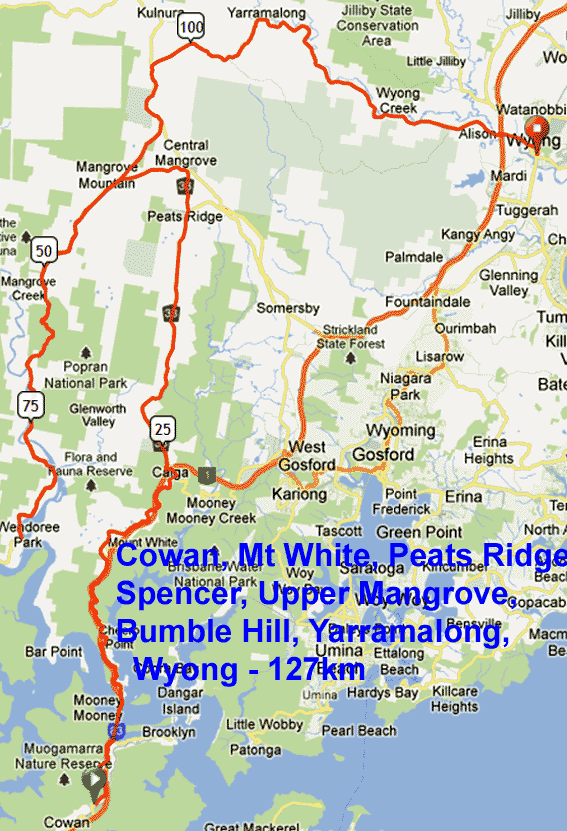 |
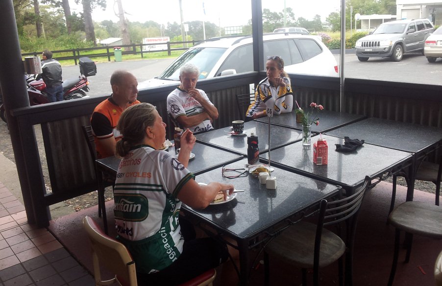
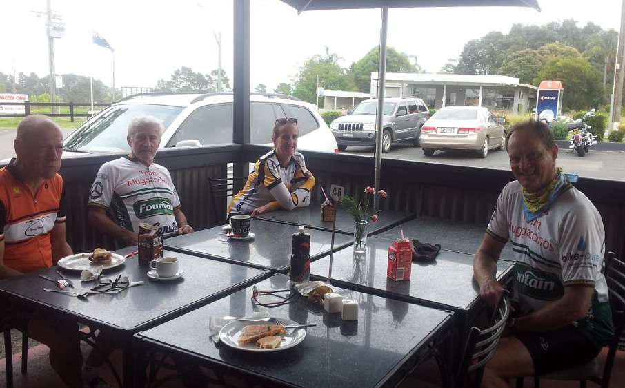
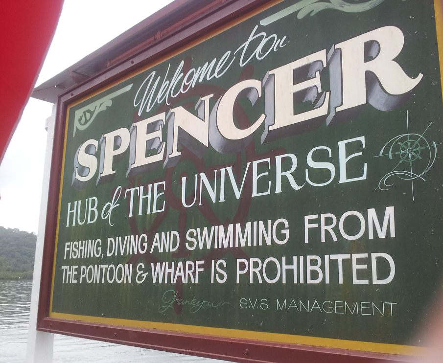
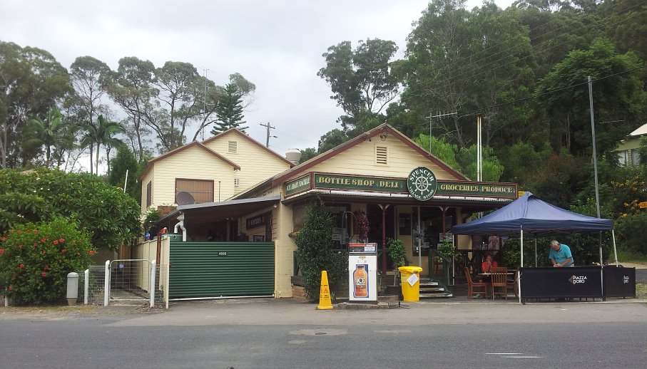
Cowan, Spencer, Wyong
- 127km - 10 crew, albeit only 6 completed the scheduled route with the
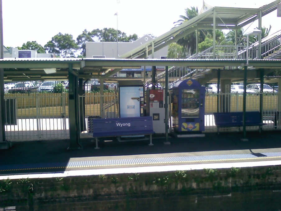
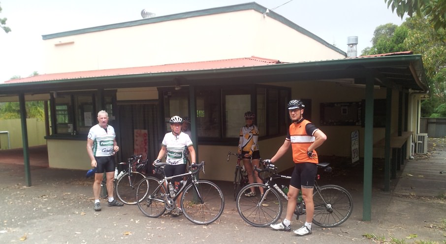
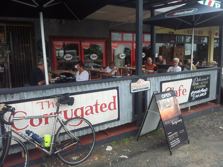
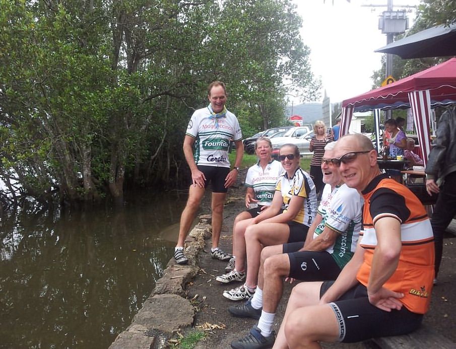
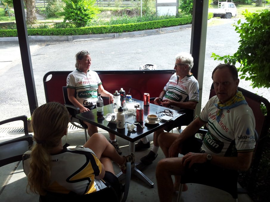
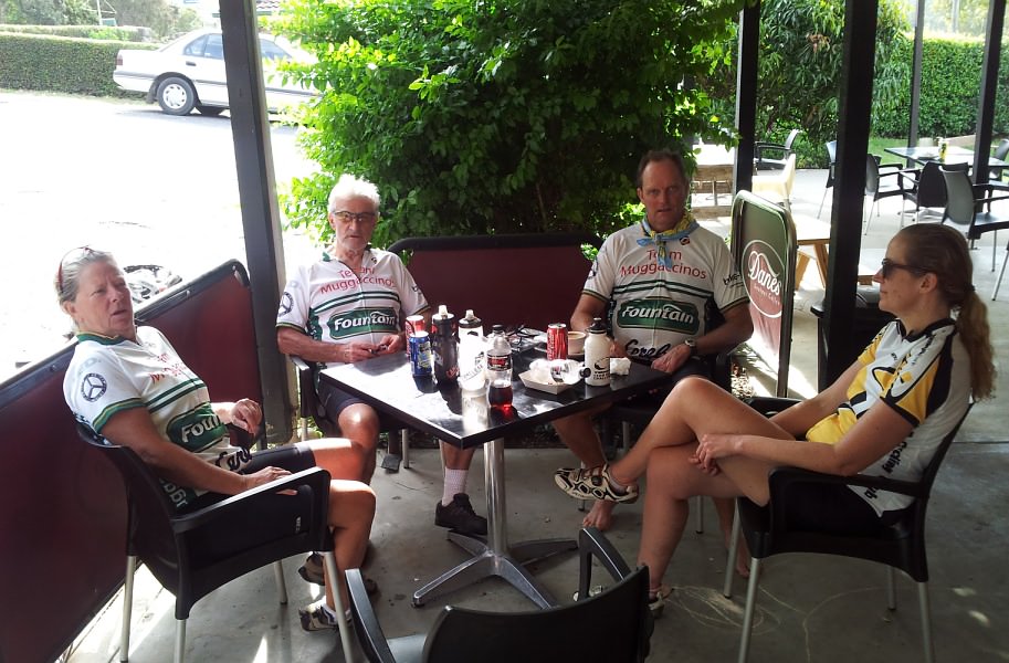
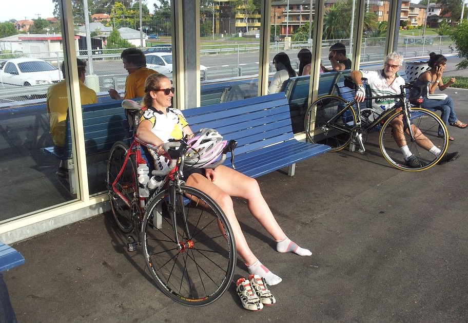
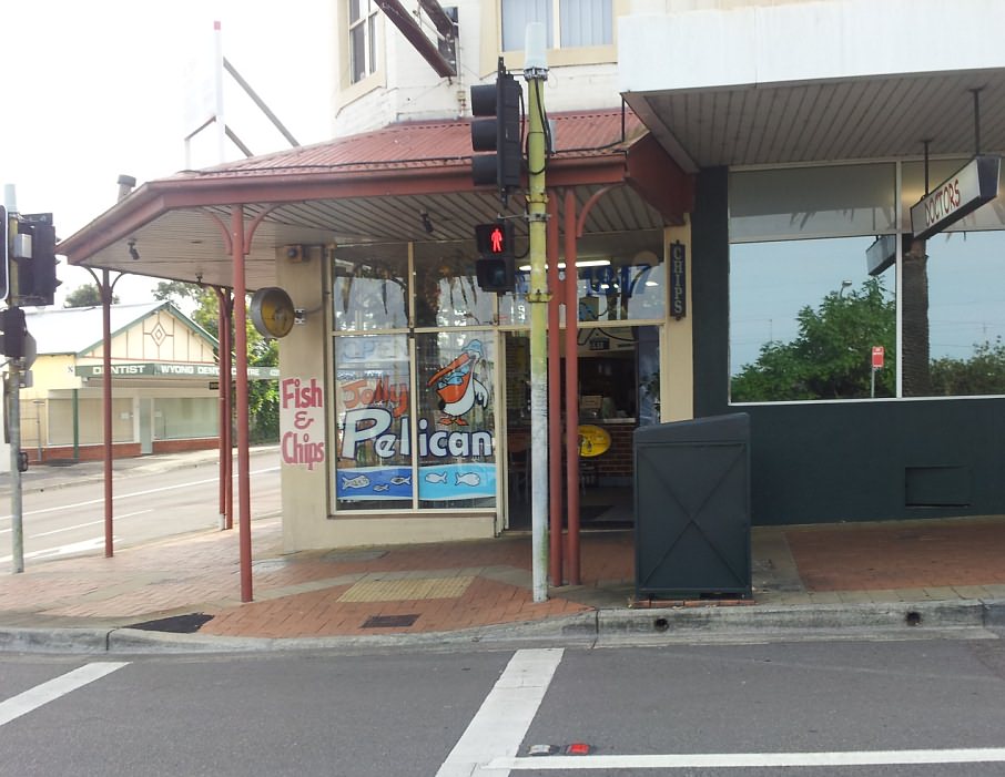
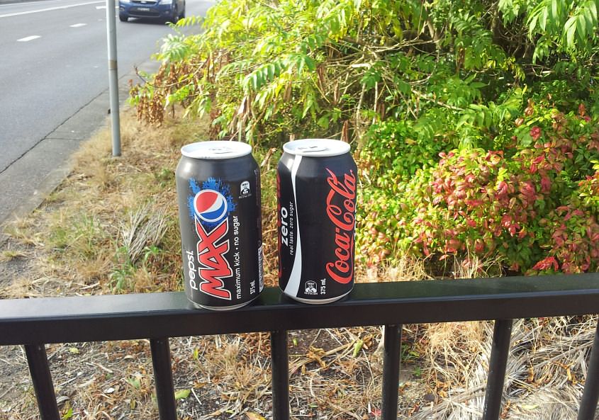
others U Turning at Mt White The tough get going when the going gets tough. Veteran Tony aka Publican peeled off 172km by starting from his Dural digs and cycling back home post-ride. Relative Spring Chicken, David aka CricketTragic, rode 142 by starting from Hornsby with Andrew aka Scallop who pissed-off early. We lost Peter aka CampyAficinado and Ann aka ToothFairy at Mt White where you could have shot off an Elephant Gun and not hit anyone. The Whippet went missing at the Optus Tower KOM. As evident in the below Elevation Profile, there were a couple of 'nasty lumps' in yesterday's ride for only the hardened, which may explain why our numbers were down. After 11km we scaled the customary 6.7km to Mt White from a km north of the Hawkesbury River Bridge, whereupon t'was an uphill grind to the 40km mark (4km north of the Corrugated Cafe, Peats Ridge) where we hooked a hard left into Wisemans Ferry Rd for the 29km downhill to The Hub of the Universe, Spencer. The below 'snaps' show it was a cultural experience revisiting Dueling Banjoes in Deliverance Country amidst the mangroves in the murky bulbous swamp. On our return route retracing up from Spencer, alas, The Friendly Grocer store at Upper Mangrove was closed for Easter, so we didn't stick the Nose Bag back on 'til Yarramalong after 109km, and a lot longer for Publican, but then again he is older and ipso facto, more experienced. Nothing beats experience. The third last pic below is subtitled "David, tell somebody who cares", showing David remonstrating on Wyong station at an understandable lack of regard for his apparent good fortune. We were waiting for the train at Wyong whereupon the next train was the Express which stopped Tuggerah, Woy Woy, Hornsby, Epping only. As all bar David wanted to disembark at Cowan or Berowra, the later 'All-Stops' slow train was the go for the rest of us. David must have told BankTeller about 5 times about how pleased he was that he could get back to Epping "in fewer stops than it takes me to catch an Express from the city". BankTeller "couldn't have given a tinker's cuss" how long it was going to take David to get home. Nor could any of the rest of us. We were just shagged and patiently waiting for the subsequent All Stops. But David struggled to 'take-in' that the rest of us were resolved to catching the slow service and we didn't really care that David was getting back to Epping faster. Final two pics evidence that BankTeller was happy to walk across the street at Wyong to buy caffeine hits for PrincessCaroline and himself at the Jolly Pelican for "two bucks", rather than getting nailed for 'four bucks' for a 600 ml (made of polluting plastic) at the drink machine on the station, especially as those Behemoth Burglars had "stolled" BankTeller's coins more than once. Hats Off to the Publican, but then again he is more experienced. BTW, that second vicious lump below from 81km was the long haul back up to Upper Mangrove that may have deterred a few other crew from yesterday's ride which will be back on again next Easter Sunday, as will the Good Friday "Two Dams". But we will have to lobby The Friendly Grocer at Upper Mangrove to open up to satisfy the throng. |

"David, tell somebody who cares"
Scribe 8 Apr '12